Description
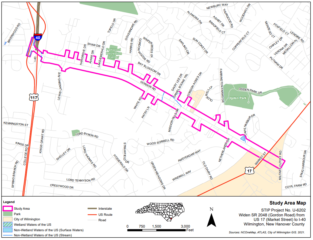
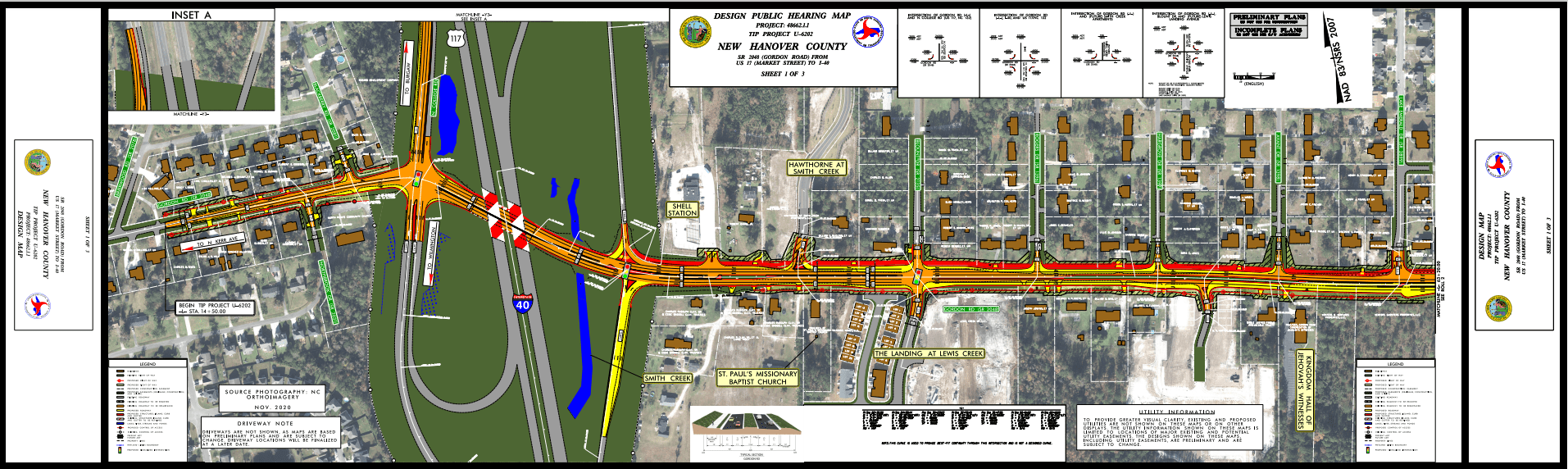
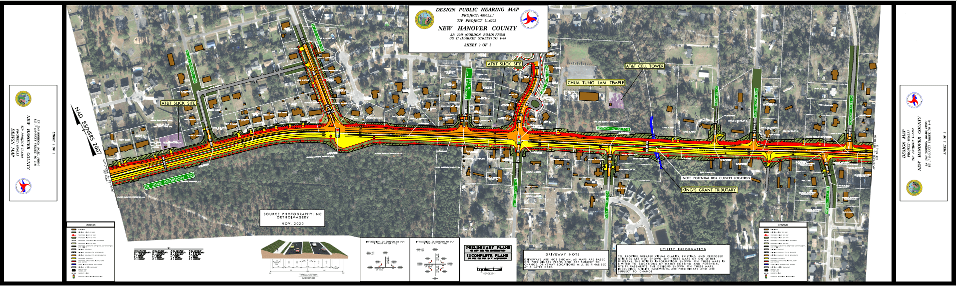
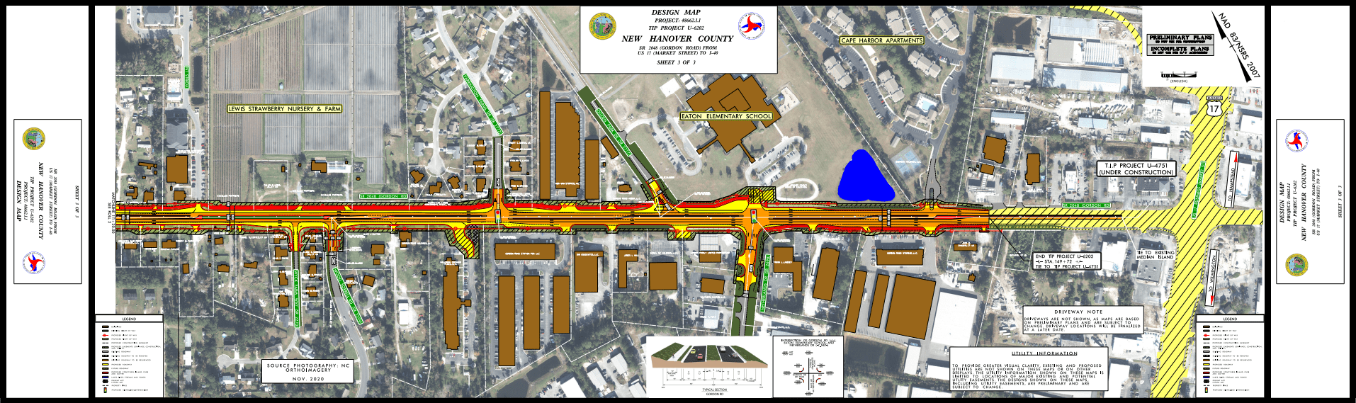
In order to prepare for anticipated continued growth in Wilmington, the North Carolina Department of Transportation (NCDOT) proposes to widen 2.5 miles of SR 2048 (Gordon Road) from two lanes of undivided road way to four lanes divided by a 17.5 foot raised median between I-40/North College Road and US 17 (Market Street). Additionally, a paved, 10-foot multi-use path will be constructed on the northern side of the widened road.
Reduced conflict intersections, (also known as superstreets, synchchronized streets, or median U-turns) will be installed at sidestreets without turn signals, requiring motorists to turn right onto Gordon Road. Drivers wanting to drive in the opposite direction will be directed into a dedicated lane to make a u-turn after first turning right onto Gordon Road. These right-in right-out only intersections will accommodate the raised median.
According to the NCDOT, the road widening project will improve safety and reduce the risk of serious crashes in anticipation of increased traffic volumes for the Wilmington area in New Hanover County.
Business and Home Owners Concerns
The Gordon Road widening may accommodate increased traffic and improve safety conditions, but property owners on the planned route should be aware of the changes being made and how their residential properties may be affected by the process, construction, and resulting traffic patterns. Just compensation for highway construction takings should be provided, but you may have to fight for it.
There also may be easements issues, which can be very tricky from a property rights standpoint. Does the government want a permanent easement or a temporary easement? What is the long-term plan? We can help you understand the possible impact to your property.
As usual, property owners stand to lose some or all of their property when the government decides it’s needed for the public good. The NCDOT will make an offer, but it’s important to remember that the offer may be low. Like any other buyer, the NCDOT wants to buy as affordably as possible and may not include full just compensation in the initial offer. We can help you fight to try to obtain that compensation!
Your property may be significantly affected by these changes. Contact us if your property is in the path of this Gordon Road widening project, and we can discuss your circumstances.